Hiking Distance It is just under 10km to hike to Devona Lookout.
Hiking Time It will take about 2.5 hours to hike to the Devona Lookout, past Celestine Lake, with a little less on the return hike.
Getting to Devona Lookout and Celestine Lake Trailhead..
The Devona Lookout and Celestine Lake trailhead is off Highway 16 and on the Celestine Lake Road, just over 13km east of the Icefields Parkway. Follow the main road 28.8 kilometers to the parking area at the hiking trailhead gate. This narrow road has many blind corners and is very hard on vehicles. Past kilometer 13, the traffic is one way. The hours in are: 8-9, 12-1, 4-5; Hours out are: 10-11, 2-3, 6-7).The Devona Lookout and Celestine Lake Hike..
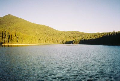
The best views when hiking Devona Lookout and Celestine Lake trail are just beyond the lookout site. You can visit Princess and Celestine lakes during the hike, with a backcountry campground (permit required) with kitchen shelter and food storage bins at Celestine Lake. Hiking trails to Moosehorn Lake and the North Boundary hiking trail are also along this route.The main hiking route follows the road crossing Snake Indian River by the World War II portable Bailey bridge. Be careful, as the bank is crumbling along the approach towards the bridge. The road does not allow vehicles beyond the gate to Celestine Lake on the old access road. Just under 7 kilometers, you hike past the access trail to Princess Lake. At the lake, you have good views of Roche de Smet just to the left.
Continue hiking on the road to the junction at Celestine Lake and campground (again just to the left). Keep hiking straight ahead on the road, which climbs steadily on an easy grade to the Devona Lookout. Trees inhibit some view with the exception of the west side. Continue hiking straight ahead from Devona lookout site on the hiking trail that leads downhill a short distance to better viewpoints.


